Connect people, plans, measurements and field operations in one intelligent workspace. Built for construction, inspection and industrial environments.
Contact Us Partnership EnquiryUNICON connects field teams, site measurements, project information and operational workflows into a single environment. It is designed to reduce information loss between office and site, support real-time decision making and create a traceable record of work performed in the field.
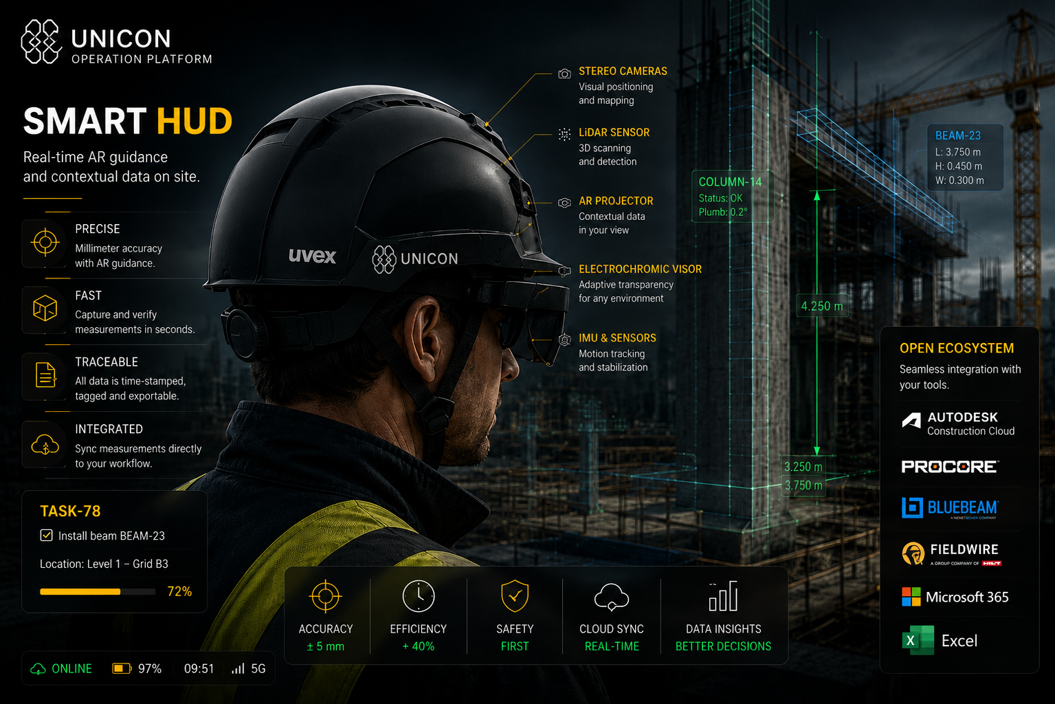
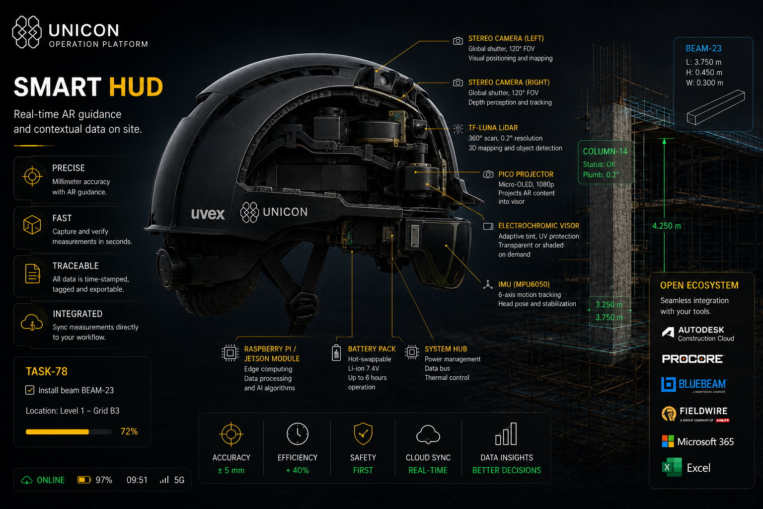
UNICON is designed to turn project information into field action, then return verified site data back to office workflows.
Import PDF drawings, documents and project information.
Convert plans, issues and instructions into structured field actions.
Send relevant instructions, measurements and context to the operator.
Use HUD guidance, spatial measurements and task support during work.
Capture measurements, status, notes and evidence from site activity.
Return structured data to managers, reports and connected systems.
Real-time information directly in the operator's field of view.
Distance, angle, level and spatial measurements.
Connect office planning with on-site execution.
Transform observations into actionable information.
Context-aware support for field operations and decision making.
Designed to connect field data with existing construction software.
UNICON V0 is being developed as a research and development prototype combining spatial sensing, visual positioning, measurement logic and field workflow support.
Keep your software. Add spatial intelligence. UNICON is designed to work alongside established construction and project management tools rather than replace them.
Planned integrations and connector architecture. Compatibility claims will be updated as adapters are developed and verified.
Field operations, measurements, task visibility and progress tracking.
Spatial reference points, measurements and structured site data.
Asset inspection, field documentation and operational support.
Inspection workflows, issue tracking and safety-critical reporting.
Vessel refit, inspection, documentation and site coordination.
Operational visibility, maintenance records and task coordination.
Research & Development Prototype: HUD, measurements, camera, LiDAR and IMU foundation.
Construction Operations Platform: field workflows, task capture and validated measurements.
Advanced Integration Layer: modular connectors for office and management systems.
Spatial Intelligence Ecosystem: connected site data, advanced automation and multi-device workflows.
Developed by NOSMO Technology Limited. For partnership enquiries, demonstrations and technical collaboration, contact the UNICON team.
Email: contact@uniconplatform.co.uk
Company: NOSMO Technology Limited
Location: Huddersfield, United Kingdom